The Bigfoot of the Appalachian Mountains
The Location
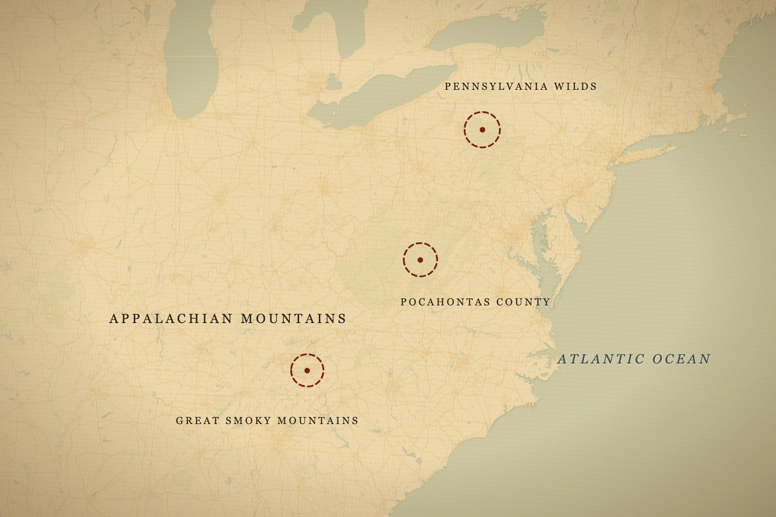
The Appalachian Mountains stretch approximately 1,500 miles from Lookout Mountain in Alabama to Katahdin in Maine, forming one of the oldest mountain systems on Earth. They predate the bones of most continents — eroded down from Himalayan heights over 300 million years into the soft, folded ridgelines we see today. For Bigfoot researchers, certain corridors within this range stand out not as isolated hotspots, but as a continuous thread of encounter reports that follows the ridge systems north and south, generation after generation.
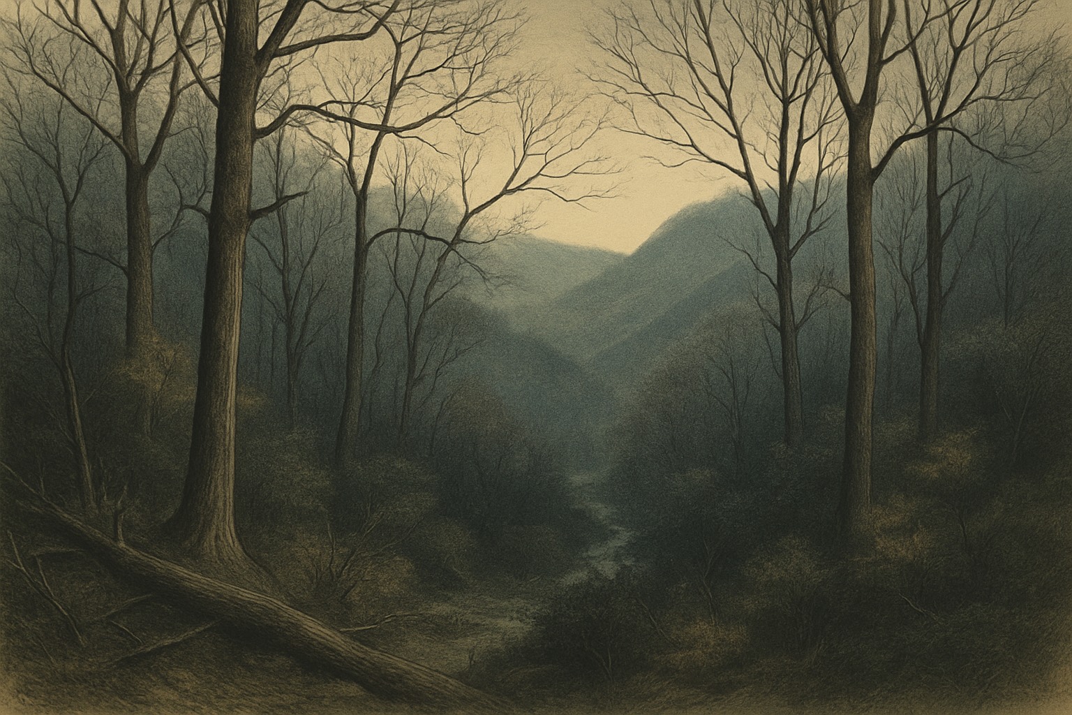
To understand why this terrain produces the volume of reports it does, you have to start with the ecology. The Great Smoky Mountains, straddling the North Carolina–Tennessee line, are the most biodiverse temperate forest in North America — more than 19,000 documented species, with biologists estimating the true number could exceed 80,000 once the unrecorded fungi, invertebrates, and microorganisms are accounted for. This is a place where new species are still being cataloged on a routine basis. The argument for an undocumented large mammal is not strengthened by that fact alone, but it does establish something important: this is not exhausted, fully-surveyed land. The canopy here hides more than most people assume.
The highest-density reporting zones cluster in several distinct areas. Western North Carolina and eastern Tennessee — particularly the Great Smoky Mountains National Park — receive the most attention. At 521,000 acres, the park draws over 12 million visitors per year but contains more than 800 miles of trail and vast roadless backcountry that almost no one ever enters. Elevations range from roughly 1,000 feet at the park boundary up to 6,684 feet at Clingmans Dome. The forest transitions from mixed hardwood — oak, hickory, tulip poplar, and remnant American chestnut — to spruce-fir above 4,500 feet, creating multiple distinct ecological zones stacked within a single drainage. Just to the west, the Cherokee National Forest spreads across more than 650,000 acres of eastern Tennessee, a quieter and less-trafficked landscape than the national park, and one that generates a steady stream of its own reports along its creek bottoms and logging roads.
Farther north, southwest Virginia, West Virginia's Pocahontas County, and the Monongahela National Forest form a second major corridor — and arguably the wildest. Pocahontas County is one of the most sparsely populated counties east of the Mississippi: roughly 9,000 residents spread across 942 square miles, much of it inside national forest boundaries. The county is over 90% forested, with population density under 10 people per square mile. This is terrain that could plausibly sustain large, secretive fauna if any exist — there are hollows here that may go years between human visits. The Monongahela itself covers more than 900,000 acres of high plateau, bogs, and red spruce, some of the most remote country in the eastern half of the continent. Finally, the Pennsylvania Wilds in the northern tier complete the picture: 2.1 million acres of contiguous forest, with documented black bear densities among the highest in the eastern United States.
What sets the Appalachians apart from the Pacific Northwest is not just terrain — it is the human culture layered over it. Long before "Bigfoot" became a national brand in the late 1950s, mountain communities here had their own names and their own stories. Old-timers spoke of the "wood ape" and the "woolly booger," handed down as oral tradition through families who had farmed and hunted the same hollows for two centuries. These were not consciously framed as cryptozoology. They were part of the texture of mountain life — a warning to keep children close at dusk, an explanation for a scream in the dark, a story told on a porch. That this vocabulary predates the modern Bigfoot phenomenon by generations matters. It means the Appalachian tradition cannot be dismissed as simple cultural borrowing from West Coast media.
Mast production — acorn and beech nut crops — cycles across the range on a roughly two-to-five-year rhythm. Strong mast years drive concentrated animal movement and would logically attract any large omnivore following food resources down out of the high country and into the river bottoms where most encounters are reported.
The Sightings
The Bigfoot Field Researchers Organization (BFRO) database contains over 1,500 reports from counties touching the Appalachian corridor, making it the most report-dense region east of the Mississippi.
The single most-documented Appalachian case is the Minerva Monster of 1978. Centered on the Cayton family property near Minerva, Ohio — on the western edge of the Appalachian plateau — the incident unfolded as a series of encounters that summer rather than a one-off sighting. Multiple witnesses across the household and visiting family reported a large, hair-covered bipedal animal around the property, and the Stark County sheriff's department investigated the reports. The sustained, multi-witness nature of the case has kept it in serious discussion for nearly fifty years. What distinguishes Minerva from a typical roadside sighting is duration and corroboration: this was not one frightened person at dusk, but a cluster of people, over time, describing the same animal.
In the 1960s and 1970s, West Virginia forestry workers operating in remote sections of the Monongahela National Forest produced a cluster of reports that remain among the most credible in the regional database. Witnesses were experienced outdoorsmen, familiar with native wildlife, and multiple encounters included physical evidence — large bipedal track casts, disturbed vegetation, and in several cases a distinct sulfurous or musky odor described consistently across independent reports.
In the North Carolina foothills, specifically Cleveland County, a local tradition of sightings stretches across generations around Carpenter Knob and the South Mountains. The creature has acquired a regional name — "Knobby" — and while folkloric elements have accumulated around the tradition, the underlying encounter reports span from the original 1978–79 wave through sightings reported as recently as the 2010s, from witnesses across several unconnected households and decades.
The physical evidence picture in the Appalachians is thinner than in the Pacific Northwest, but not empty. Track finds turn up in the eastern record, and the feature analysts look for in any serious cast is the mid-tarsal break — a flexion point in the middle of the foot, marked in a cast by a pressure ridge in the soil, a signature anthropologist Jeff Meldrum has documented extensively in casts from the western states. Human feet do not flex there; our arches are rigid. But the foot bones of known great apes do articulate at roughly that point, and casts displaying this mid-tarsal pressure pattern are among the harder pieces of evidence to explain through casual hoaxing, because faking it requires anatomical knowledge most pranksters simply don't have. What the East has not yet produced is a cast documented to that standard — an honest gap in the regional evidence base, and one worth sitting with rather than papering over.
Notably, the Appalachian Bigfoot is described differently from its Pacific Northwest counterpart, and the differences are consistent enough to be worth cataloging. Appalachian animals tend to be reported as shorter — typically 6 to 7 feet, against the 7 to 9 feet common in western accounts. Coloration skews lighter and more varied: reddish-brown shows up frequently, and gray individuals are reported often enough that "gray ones" has become a regional descriptor. And the eastern animal is far more frequently associated with water. Witnesses describe encounters in creek beds, along river bottoms, and on the gravel bars of mountain streams at a rate that stands out clearly from the western data. Whether these differences reflect a genuinely distinct population, environmental adaptation, observer bias, or simply a different culture of witnesses is an open question — but the internal consistency of the eastern profile is itself a data point worth taking seriously.
What the Shows Covered
Finding Bigfoot (Animal Planet, 2011–2018) worked the East from its very first season: the North Carolina episode, "Caught on Tape" (Season 1, 2011), was built around a piece of footage from the Uwharrie National Forest in the state's central hills, and the team returned to the broader region — West Virginia among the stops — across the show's nine seasons. The town hall format that became the show's most valuable evidence-gathering tool was well suited to this part of the country, where the witness pool runs unusually deep.
That depth is the real Appalachian story, and it shows up in the regional sighting databases whether or not a camera crew is present: independent accounts from the same hollows, decades apart — an older witness describing something seen as a child on a particular ridge, a recent report describing something on that same ridge last summer. This pattern of geographic persistence across generations is difficult to explain through social contagion alone, and it is the single most compelling feature of the Appalachian witness record.
What the shows did not produce here is a definitive artifact. No cast, recording, or thermal hit from the region's television visits has survived scrutiny any better than the rest of the national file. In the Appalachians, the witness record — not the field footage — is the case.
Matt Moneymaker's assertiveness occasionally undermined the credibility of the show's methodology, but the Appalachian episodes benefited from a higher baseline quality of witness testimony than many other locations the team investigated.
Field Assessment
The Appalachian range presents a compelling case not because of any single dramatic piece of evidence, but because of the geographic coherence of the report distribution. Sightings cluster along ridge systems and river corridors in ways that mirror the movement patterns of known large mammals — black bear, the disputed eastern mountain lion, and white-tailed deer. Overlay a Bigfoot report map with a black bear range map and a mast production map and the correlations are notable. Whether that reflects a misidentified bear population, a genuine unknown species, or some combination remains unresolved.
But the Appalachians pose a research problem fundamentally different from the Pacific Northwest, and it is worth being honest about how severe it is. In the West, the most active areas are largely public land — vast national forests and wilderness areas a researcher can legally walk into and work for days. The Appalachians are the opposite. Outside the national forests and parks, much of the most active terrain is privately owned, and in mountain country it is almost universally posted. The hollows that generate the richest multigenerational reports are frequently family land, fenced and signed, where a researcher cannot set a camera trap or run a night operation without explicit permission that is rarely granted to outsiders. The practical consequence is that the very places where the witness record is strongest are the places fieldworkers can least access. That access gap, more than any shortage of reports, is what has kept the eastern data thin on physical follow-up.
Technology helps less here than people expect. Aerial and tower-mounted thermal imaging — the great hope of modern Bigfoot fieldwork — is largely defeated by the Appalachian canopy. From roughly April through November, the broadleaf forest closes into a dense, continuous ceiling that radiates its own heat and hides whatever moves beneath it. For eight months of the year, aerial thermal is effectively useless across most of the range. The window when bare branches make it viable is the same window when cold, snow, and short days make sustained field operations hardest. The terrain that hides the animal also hides it from the tools built to find it.
The alternative explanations are real and deserve honest treatment. Black bears do occasionally stand upright. Experienced outdoorsmen do misidentify wildlife under low-light conditions. Regional folklore — the wood apes and woolly boogers handed down for generations — shapes how witnesses interpret and report unusual experiences. These factors account for a percentage of the Appalachian report database. The honest question is whether they account for all of it.
The reports that are hardest to dismiss involve experienced woods workers, consistent physical descriptions across independent witnesses with no apparent connection, and physical evidence — track casts with dermal ridges and mid-tarsal flexion, large stride lengths inconsistent with any confirmed species — that would require significant effort and uncommon knowledge to fabricate in remote terrain.
What would it take to confirm? A clean biological sample tied to a traceable encounter would settle the question definitively. Until that exists, the Appalachian corridor deserves continued, methodical attention — and, critically, the patient relationship-building with landowners that is the only realistic path to working its best terrain. The ecology supports it. The witness history runs centuries deep. The question is not closed.
Covered On Screen
- Time's Running OutFinding Bigfoot · S2 E5
- Turtleman's BigfootFinding Bigfoot · S6 E1
- "Mother Bigfoot"[6]Finding Bigfoot · S3 E3
- Creepy HollowsFinding Bigfoot · S2 E3
- "Caught on Tape"[2]Finding Bigfoot · S1 E3
Track sighting locations from this post on the interactive map.
Free account · mark visited sites · build your field list.
Open the tracker